Source: Link
CHARLAND, LOUIS, surveyor, office holder, architect, and militia officer; b. 6 April 1772 at Quebec, son of Alexis Charland and Marie Poulin; m. first 17 Jan. 1803 Marie-Joseph Fearson on Île Perrot, Lower Canada; m. secondly 22 Feb. 1810 Sarah Jones in Montreal, Lower Canada; d. there 3 Sept. 1813.
Louis Charland entered the Petit Séminaire de Québec in 1785 and finished his studies there in June 1792. Shortly afterwards he started to learn surveying with a man by the name of Jones. In 1793 he was appointed deputy provincial surveyor by Samuel Johannes Holland, surveyor general of Lower Canada. That year also he gave the public the benefit of his scientific knowledge by providing answers in the Quebec Gazette to questions concerning geometry and surveying. Having received his commission as a surveyor in August 1795, he worked until 1799 in the Quebec area, where he does not seem to have been very busy, judging by the limited number of reports of surveys done for the region.
At that period the maintenance of roads and streets in Montreal was the subject of much complaint by the citizens. In 1799, therefore, the House of Assembly passed a bill amending one adopted three years earlier concerning the construction and upkeep of roads in Lower Canada. The 1799 act stipulated, among other things, that two surveyors would be appointed, one at Quebec and one at Montreal, and that each would receive an annual salary of £100 and would be put under the immediate authority of the justices of the peace, whose powers extended to municipal government. At 27, Charland became the first surveyor of the highways, streets, and lanes in Montreal, and he took up permanent residence in that town to pursue other professional work as well. He signed many boundary surveys or measuring reports in Montreal and the surrounding area, and sometimes these documents were accompanied by plans prepared with exceptional care.
As road surveyor Charland was responsible for supervising the maintenance of roads, streets, and bridges, hiring the manpower for repair work, and levying fines. He held this office without interruption from his initial appointment in June 1799 until his death in 1813. In this capacity he drew up in 1801 the “Plan de la ville et cité de Montréal avec les projets d’accroissements”; his intent was to make the boundaries of the urban agglomeration, in which the suburbs were developing more rapidly than the central area, correspond more closely to the actual situation.
Charland’s name is also linked with the demolition of the old fortifications which, in addition to being of no military use, were a serious block to the town’s growth. In 1803, following the recommendation of the commissioners John Richardson*, James McGill, and Jean-Marie Mondelet*, who were entrusted with directing the demolition, Charland prepared a plan of the fortifications to serve as a reference for future development of the town. On the work site he took charge of inspecting such projects as the extension of streets and the repair of embankments; he signed payment authorizations, and proceeded to survey numerous places where the fortification walls stood, in order to return them to their legitimate owners. He continued to do such jobs, which brought him supplementary income, until his death. The work of demolition itself was not completed until 1817. During his years in Montreal Charland had in addition prepared an undetermined number of plans for public buildings, among which were the Montreal court-house (1799), the prison (1808), for which he directed the work, and the buildings on the Place du Marché (1809).
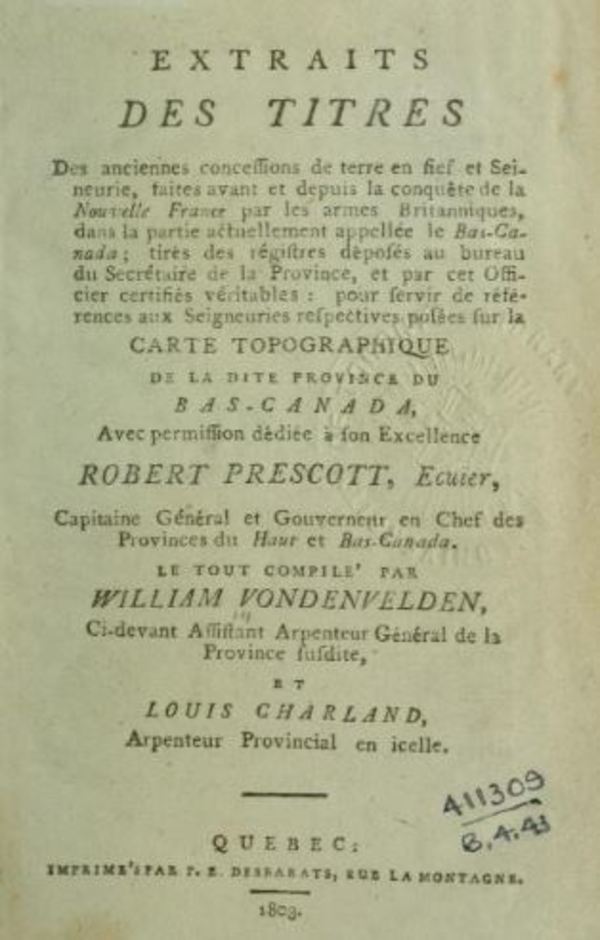
While making his career in the public service Charland had undertaken other projects, and some of these turned out well. In collaboration with the surveyor and printer William Vondenvelden he prepared A new topographical map of the province of Lower Canada. It was published in London in 1803 and was only surpassed 12 years later by the work of Surveyor General Joseph Bouchette*. To accompany their map Charland and Vondenvelden published at Quebec in the same year a volume entitled Extraits des titres des anciennes concessions de terre en fief et seineurie. Charland was also capable of conceiving ambitious projects; for example, on 27 Feb. 1812 he put an advertisement in the Quebec Gazette announcing his intention to claim the exclusive right to open a canal between Montreal and Lachine.
Charland was less successful in his attempts to obtain land in the Eastern Townships from the government. In 1796, with a group of associates, he asked for 64,000 acres in the Lac Mégantic region which were refused him; his request that year for a grant of 5,000 acres in the vicinity of Brompton and Orford townships was also rejected. In the latter case the land ended up in the hands of another surveyor, Samuel Gale*. From 1801 until his death Charland served as a militia officer; in April 1812 he obtained the post of adjutant and six months later became deputy quartermaster general of the Montreal mititia.
Louis Charland was more than the “good official” he has been termed. His contemporaries certainly had confidence in him, to judge by the number of offices he held concurrently. The excellence of his cartographic works and his plans is likewise recognized. Jacques Viger*, who succeeded him as road surveyor, could have testified to it: commissioned to do a plan of Montreal, he had difficulty obtaining payment because it was apparently too much like Charland’s works.
Louis Charland’s surveyor’s notebooks for 1793–1813 are deposited at the ANQ-M, CA1-16. With William Vondenvelden, Charland published A new topographical map of the province of Lower Canada compiled from all the former as well as the latest surveys . . . (London, 1803) and compiled Extraits des titres des anciennes concessions de terre en fief et seineurie, faites avant et depuis la Conquête de la Nouvelle France par les armes britanniques dans la partie actuellement appellée le Bas-Canada . . . (Québec, 1803).
ANQ-M, CN1-16, 25 juill. 1809. ASQ, Fichier des anciens; Fonds Viger-Verreau, Sér.O, 0165–71 (copies at PAC). PAC, MG 30, Dl, 7; RG 1, E15, A, 280, 290, 317; E17; L3L: 29603–10; RG 4, A1: 21716–18; B33, 18; RG 8, I (C ser.), 1203 1/2G: 13. Quebec Gazette, 7, 14 Feb., 7 March, 4 April 1793; 20 Aug. 1795; 20 June 1799; 27 Feb., 23 April 1812; 16 Sept. 1813. Bouchette, Topographical description of L.C. Quebec almanac, 1795–1813. J.-C. Marsan, Montréal en évolution: historique du développement de l’architecture et de l’environnement montréalais (Montréal, 1974), 160. É.-Z. Massicotte, Faits curieux de l’ histoire de Montréal (Montréal, 1922), 62–63. Albertine Ferland-Angers, “La citadelle de Montréal (1658–1820),” RHAF, 3 (1949–50): 509. P. Scribe, “Louis Charland,” BRH, 34 (1928): 330–36.
Cite This Article
Gilles Langelier, “CHARLAND, LOUIS,” in Dictionary of Canadian Biography, vol. 5, University of Toronto/Université Laval, 2003–, accessed December 30, 2025, https://www.biographi.ca/en/bio/charland_louis_5E.html.
The citation above shows the format for footnotes and endnotes according to the Chicago manual of style (16th edition). Information to be used in other citation formats:
| Permalink: | https://www.biographi.ca/en/bio/charland_louis_5E.html |
| Author of Article: | Gilles Langelier |
| Title of Article: | CHARLAND, LOUIS |
| Publication Name: | Dictionary of Canadian Biography, vol. 5 |
| Publisher: | University of Toronto/Université Laval |
| Year of publication: | 1983 |
| Year of revision: | 1983 |
| Access Date: | December 30, 2025 |


