Maps
Source: Courtesy of Wikimedia Commons
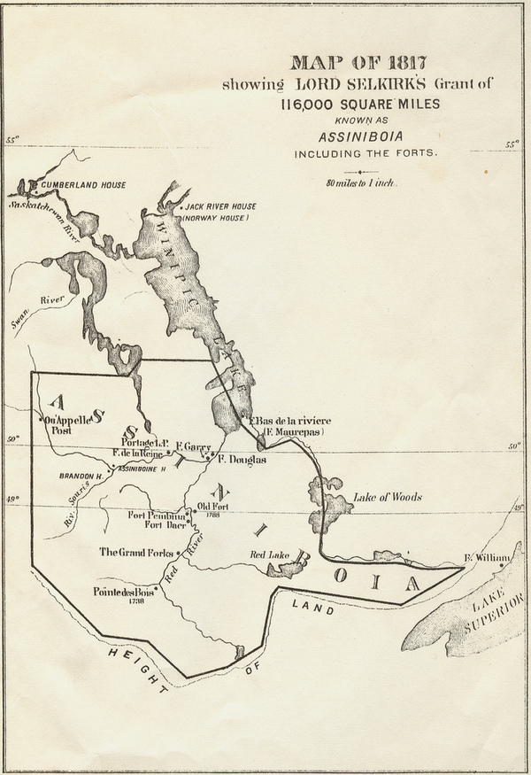
The map from 1817 shown above illustrates the concession of some 116,000 square miles made by the Hudson’s Bay Company (HBC) to Thomas DOUGLAS, 5th Earl of Selkirk, in 1811. This territory, at the heart of which the Red River settlement was founded, now covers parts of Manitoba, and what are now the states of Minnesota and North Dakota. The Convention of 1818, a treaty signed between Great Britain and the United States, drew the border between British North America and the United States along the 49th parallel from the Lake of the Woods to the Rocky Mountains. The HBC trading post at Pembina, home to settlers and missionaries, is now in American territory. In 1822–23 John HALKETT (Wedderburn), Selkirk’s cousin and the colony’s administrator, ordered the post closed, its village abandoned, and its mission’s activities ended. The Pembina inhabitants were encouraged to move near other settlers on the banks of the Red and Assiniboine rivers. Until 1870, the colony’s population concentrated there. It was at the confluence of the two rivers that a new urban centre, Winnipeg, would emerge during the 1860s.
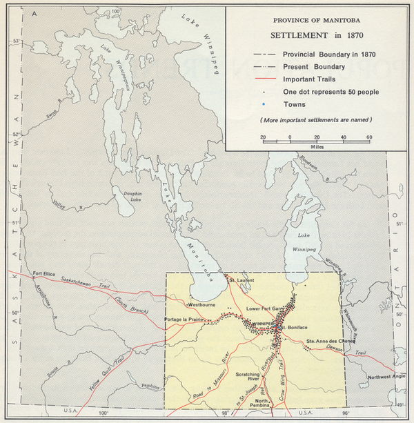
The map below shows the initial territory (approximately 14,000 square miles) that constituted the province of Manitoba upon its creation in 1870. After several years of tension and negotiations with the federal and Ontario governments, its size was increased to around 84,000 square miles in 1881, and then to some 251,000 square miles in 1912. The 1912 boundaries remain intact today.